
 US and Canada Shipping Only
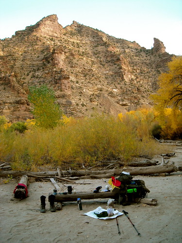
I first laid eyes on Desolation canyon when I picked up a guide book for hiking while I was driving through Utah in 2008. I sat in my truck flipping through the guide book after buying it and remember seeing the authors pictures. The pictures said it all. That was where I wanted to go. It took me a year and change to finally do it but it was worth the wait. Below are a select few of the photos I took while hiking this amazing piece of ground. I will try to give somewhat of a short narrative of my hike while letting photos fill you in on the rest. Day 1.
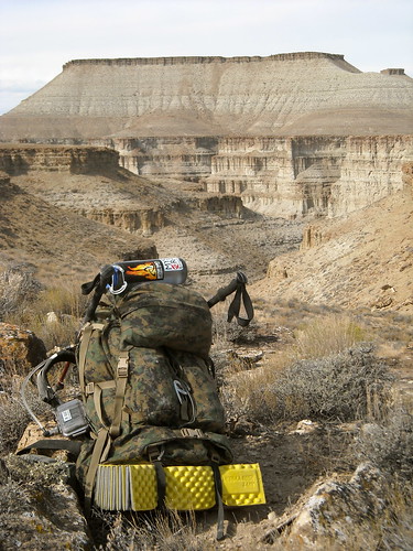
- A few miles later I got this great view looking down into nine mile canyon – This picture also showcases my Nice 6500 in digi-camo (every stitch of which was sewn by yours truly).

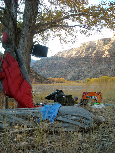
Finding this antler really felt like a good omen at the time. Below is an excerpt of my journal entry for the day.
October 20th 2009.
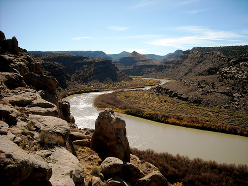
The mouth of maverick canyon… Almost ran out of water today – If I have to hike north from here will first try along river. If bad – abandon everything but water supplies for hike to 9 mile creek. “ Day 2.
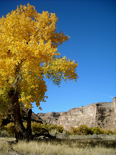
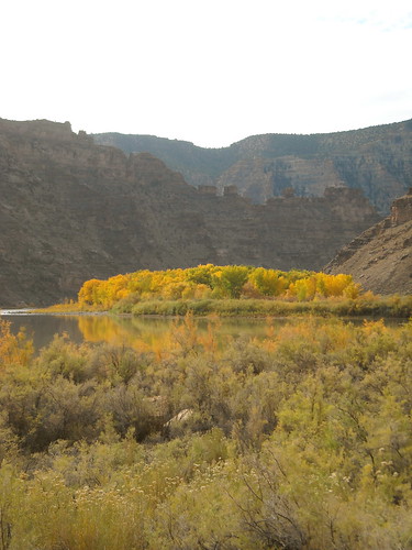
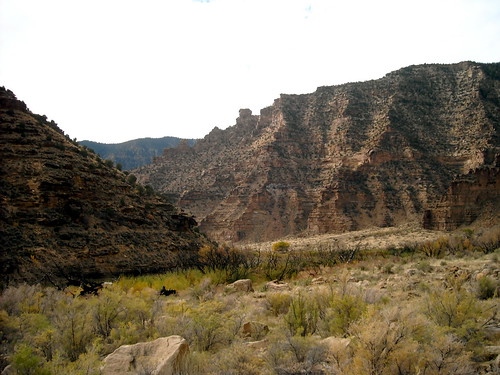
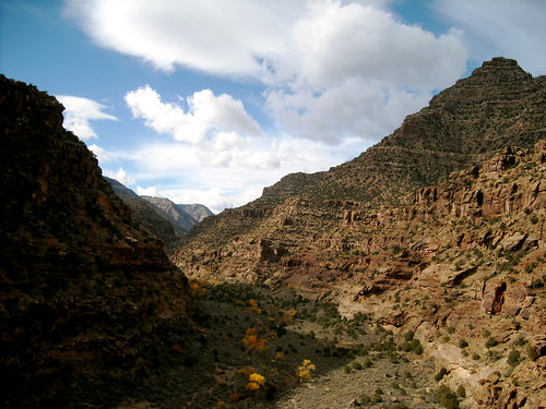
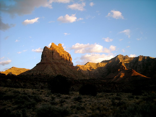
October is a beautiful time in Utah, the leaves are changing colors bringing a new shade to this barren landscape.
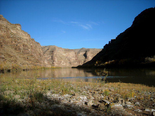
It was about this point where I really started to feel like I was truly engulfed in the canyon.
Day two, my journal entry is below.
“ October 21st 2009 Across river from Peters Point. Day 2 feeling far more successful than day 1… Pack still heavy at end of the day – navigated “problems 1 and 2” without much difficulty. “I admire your walk” is what he said as he threw me a beer. Things are looking favorable thus far. “ Day 3 It was about this time that I really started talking to myself. Singing songs that I could remember to entertain myself while hiking. Warning: I listen to hip-hop.
 In the midst of a desert wasteland stands a glimmer of hope. This cottonwood forest hides in desolation canyon from prying eyes. As I rounded the corner to this sit I went from whispering slim thug lyrics to my self, four letter words… to simply taking a picture in all about about 30 seconds.
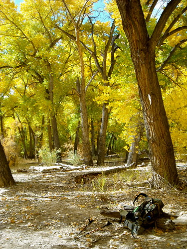
Not a bad place to eat lunch eh?
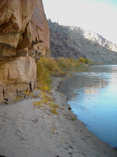
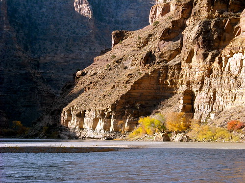
This is “Problem 3” in the guidebook. As you can see if the water level is high you get cliffed out. The river was at around 3000 c.f.s. when I hiked.
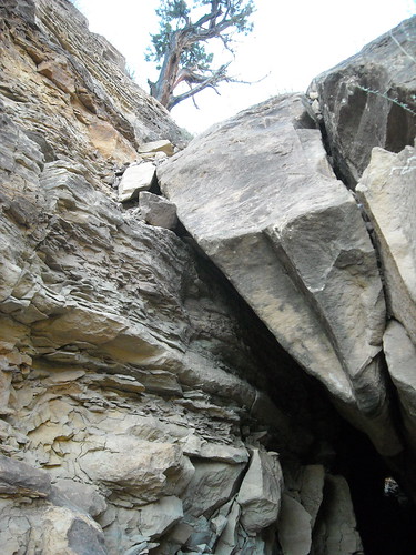
Right after problem 3 there is a boulder that you have two options on, up and over or underneath. Being that I was in eyesight of where I was camping that night I rushed up and over – only to find out I could have avoided the hassle by taking my pack off and going through a tunnel between the boulder and the cliff face… shocker.
Journal “ October 22nd 2009. Camped at rafters entrance to ceder ridge canyon… hiked around the corner to see “Problem 4” – from a distance it looks impossible to follow the “ramp” which from what I saw was completely overhung. Luckily for me I think my float plan is going to work. “
Day 4
I woke up ate, packed my stuff into the three contractor garbage bags I had brought staggered in my pack with the most important stuff like my sleeping bag and base/insulating layers in the bottom and so on. Hiked down to the spot I was going to put in at and waited. It wasn’t until about 11:00 that the sun was high enough to warrant jumping in the cold water.
Unfortunately I don't have any pictures of the float or the sweet setup I had with the pack attached to the inner tube acting as a counter weight so you could really lean back and lounge.
This is a fire that happened when the pilot of a single engine Cessna crashed into the canyon bottom. Unfortunately for the pilot he was deemed liable and survived the crash . Back country pilots landing in the canyon is becoming an all to common problem.
Journal “ October 23rd problem 4… Floated problem 4. Had to wait until damn near 11 to get sun on the water – it worked but was too cold and not much control… Need to look into backpackers inflatable kayak. Made it further than expected today! Problem 4 looks do-able with someone else there to pass packs. Seems like it is colder tonight – hopefully it stays sunny. “ Day 5 –
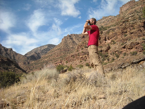
By day 5 I had a few things figured out about getting through this canyon. That or 5 days is how long it took me to figure things out with a map, compass, and guide book. I can be seen here looking through the bino's for the game/old cattle trail to take me over a cliffed out section of river to the rock creek ranch.
First real trail since day 1.
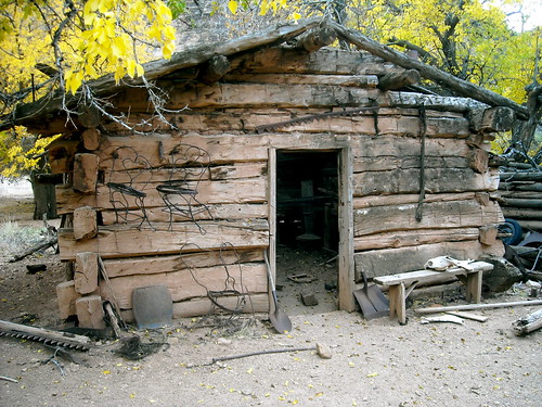
This is the rock creek ranch. It is somewhat of a outdoor museum from a time when even fewer people travelled this path. It is part of the canyons history and should be respected as that.
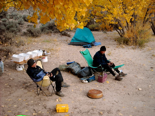
This one is going to require a little more explanation that what my journal entry has. These two gentlemen who will remain un-named are river rangers for the BLM. I met them just after leaving the rock creek ranch. If I had sat down for another 5 minutes at the ranch theres a decent chance I never would have met them. Meeting people in the middle of nowhere always seems to be a dramatic experience. I’m happy to say that running into these river rats was a dramatically positive one. In one night I managed to learn more about the canyon I was walking through than I could have ever hoped. I found out that Rock Creek Ranch is private. That in fact it is the only piece of private land in 80+ miles of river. This in my opinion is sad. I have learned in my 25 years that theres a time and place for everything. I think the middle of desolation canyon is no place for private land. I think the time to do something about it is now. If you feel that same way- write a letter, make a phone call, voice your opinion in any forum that will listen.
 Day 6 –
Journal “ October 25th 2009 Florence creek. Covered a whole quad map today. “Take back your existence or die like a punk” – Outkast. “
Day 7 –
This was taken late in the afternoon on day 7. This was the last picture I took on day seven. Unfortunately it doesn’t tell the whole story. I won’t bore you with all the details but I will say this – it brought to mind a scene from the big Lebowski where the sheriff of Malibu throws a coffee cup at “the dude”.
Day 8 –
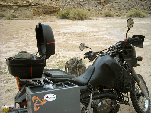
1pm – The safety of two wheels and a whopping 37 hp. At this point I hauled ass to green river where I spent 2 nights holed up in a motel 6 while the first winter storm of the season hit. When the storm cleared I made my escape back to sand wash and my truck, but not before riding through 50+ miles of dirt roads covered in snow and ice. Luckily I’m really good and riding slow. Making it hard to do any serious damage to yourself or your bike. All in all I hiked from Sand wash to Nefertiti rapids which ends up being somewhere short of 90 river miles. I didn’t see a trail for the first 5 days of my trip which made this a unique back country experience. I ask that anyone planning on attempting this hike respect the ethics that were adhered to by the previous people who’ve hiked it. I also recommend getting in touch with the BLM river rangers who have an office in price and staff at sand wash from april through october. I’m not sure how many miles I actually hiked, but to those of you who have done something similar- know that the numbers really aren’t important when it’s all said and done. Whats important is what has been learned on the journey.
Pat Gladics. patgladics@gmail.com Additional resources to contact on the the Rock Creek Ranch issue are: www.nature.org