 US Shipping Only
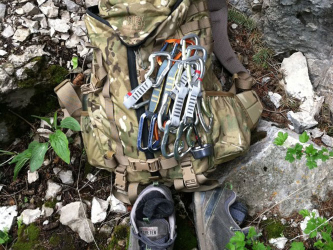
The day was perfect with rainy weather being blocked by the Paradise Valley Range plus sunny weather offering a cool breeze. We got about 5 pitches in for the day, taking it easy as we had a new puppy in our hands, making her “less than a hand count” trip out to the crag’s. This place brings solitude as you are constantly surrounded by the noise of the water gushing through the rock and the serene green habitat with wild flowers everywhere makes it a destination area for climbers. It still amazes me, when I go out climbing, that the hours can fly by feeling like I’ve only been there for an hour or two. The present moment is definitely a part of this lifestyle and this is definitely a contributing factor to why I enjoy this sport.
Natural Bridge History Lesson
Montana has two Boulder Rivers. One is in the west central part of the state and runs into the Jefferson River near the town of Cardwell. The other Boulder River is a tributary of the Yellowstone and originates high in the Absaroka Mountains south of Big Timber MT. This Boulder River offers great visiting experiences for the Montana hiker, camper, angler or visitor.
The headwaters of the Boulder lie in the Absaroka Beartooth Wilderness. This vast wilderness borders Yellowstone National Park and is one of the wildest areas in the lower 48 states. The Boulder springs from snow melt in the high mountains and travels nearly 30 miles on public lands (mostly US Forest Service) before it leaves the mountains and op-ens into a broad open agricultural valley. The Boulder River has long been renowned within Montana for its excellent recreation opportunities and many residents will tell you that the Boulder is one of their favorite places to visit.
Natural Bridge as seen in low water. The dry creek bed is obvious above the falls. The river has completely gone underground upstream of here and works its way through the porous sandstone to where it shoots out to become a surface river again. In high water the entire creek is pouring over the edge as well as through the underground channels. Prior to its collapse in 1988 the creek was spanned by a natural bridge that gave the park its name.
State Hwy 298 parallels the river until you hit the National Forest boundary and it becomes the graveled Boulder River Road.. Heading South from Big Timber Montana, 298 is an excellent paved road that runs through a broad valley studded with family ranches. This is productive agriculture land and the working ranches that fill the valley serve as a reminder of Montana’s cultural history. The lands surrounding the river are private property and, although Montana has very progressive access laws, it is difficult to access the river through this stretch.
About 16 miles south of Big Timber, Montana you reach McLeod, Montana where the first post office in the Boulder valley opened in 1886. This tiny town is at the junction of the West Boulder and main Boulder Rivers. The West Boulder is a sizable tributary that is very well known for its fine fly fishing and great hiking trails. A significant gravel road intersects with Hwy 298 near McLeod. this road, the Swingly Road, travels cross country to the outskirts of Livingston, Montana and makes a great drive as well as a take-off for other hiking trails and explorations.
Just outside of McLeod there is a Montana State Fishing Access Site located on the river. The Boulder Forks Fishing Access Site offers great access to an excellent fishing section of the Boulder River. Anglers in the Boulder fish for native Yellowstone cutthroat trout and Mountain whitefish as well as for wild brown and rainbow trout. The river is open to fishing all year long but most anglers find the best success in summer and fall.
Continuing through McLeod, the highway continues south toward the rapidly approaching mountains. After about three miles the East Boulder River enters and there is an access road that you can take that leads to several trailheads in the East Boulder Drainage. The East Boulder is a significant mining area that was first developed in 1893 when Ansel S. Hubble, one of the first prospectors in the area, filed claims in the East Boulder drainage. Today, the East Boulder Mine is a significant underground mine that producing large amounts of platinum and palladium.
At high water the Natural Bridge Falls is a very impressive sight. The water flowing over the lip is enhanced by the flows erupting from the underground waters. If you look closely you will see Ian Garcia in his kayak going over the top of the falls. Although he was ejected from his kayak, Ian was able to swim out of the maelstrom at the base of the falls.
Another 5 miles south of the East Boulder junction the paved road ends and you enter the Gallatin National Forest where you immediately reach the Natural Bridge Falls Picnic Area. This Forest Service day use area is a fantastic place to visit and well worth the trip to see. The Natural Bridge Falls is created when the Boulder River pours over the lip of a 105 foot tall limestone rock layer. This rock is soft and easily eroded and historically there was a beautiful natural bridge that spanned the river here. Unfortunately, the Natural Bridge collapsed in 1988 and all that remains are memories and photos. However, the falls remain and they are spectacular. The nature of the rock layer is such that it erodes easily and several major underground channels have been cut through the rock. In low water the entire river goes underground above the falls and erupts from several places to create a river bursting out of a cliff wall. At high water these streams are joined by the bulk of the river pouring over the lip.
This is an impressive falls. At high water the Boulder is a significant river and the water shoots over the falls with an amazing force. The Boulder River has always been the playground for boaters (mostly kayakers) and it is easy to imagine that many have looked at the falls and wondered if it would be possible to survive an attempt at jumping the falls. One man decided that he had to find out and in 2008 Bozeman native Ian Garcia kayaked over the falls. Ian is a noted waterfall jumper and had studied this for years. He survived the jump but did have to swim after being ejected from his boat. Read more about the kayaker boats over Natural Bridge Falls.
The Natural Bridge Falls parking area is right next to the road where the highway ends and the gravel road begins. There are handicap accessible outhouses, paved trails, interpretive signs and many river overlooks. This is also the trailhead for the Green Mountain Trail which is reached by crossing the river on the sturdy bridge. Casual visitors will want to cross the river and follow the trail heading downstream. You will quickly come to the vantage points opposite the Falls where the photos on this page were taken. The hike is about a quarter of a mile on gentle trail that crosses a mixture of clearings and forested areas.
From Natural Bridge you can either return or continue on the one-way road into the mountains. The Boulder River Road makes a very deep incursion into the Absaroka Beartooth Wilderness and you can drive for an additional 25 miles or so on the gravel road. This road can be very rutted and slow driving so don’t ever plan to hurry if you drive this road. There are a number of private inholdings along the road but most of the land is National Forest. There are a number of developed campgrounds maintained by the Forest Service. In addition, there are multitudes of informal camping spots on forest land along the road and river.
The river is the primary attraction of the upper Boulder Valley and fly fishermen from afar visit to fish for the wild trout that inhabit these waters. The upper Boulder River is also very popular with whitewater kayakers who come in the spring to enjoy the wild waters of the Boulder. The 20 plus miles of river above Natural Bridge offer some very difficult water and serious boaters flock to the Boulder for spring run off. If you want to float these stretches of the river you must be prepared and this site is not the place to get the info you need. Please, do your homework and do not consider boating on the Boulder until you are certain you understand the boating conditions.
The Upper Boulder is classic mountain terrain and, as should be expected, there are many fantastic hiking trails that take off from trailheads along the road. The upper sections of the river are actually just over the mountains from the Paradise Valley of the upper Yellowstone River. Just head west from the upper Boulder and you will encounter Crow Mountain which is easily hiked to from the Mill Creek drainage on the other side of the mountains.
Beyond the end of the Boulder River Road there are jeep trails that lead even higher and further. There was a history of mining on the highest mountains in the area and there are private mining lands at the top of Independence Peak, which is to the east of the River. I don’t recommend that you try to travel these 4wd roads. Rather, stay with the main road which ends at about 8,000 ft elevation in a meadow surrounded by 10,000 ft peaks. From here there are trails into the Absaroka Beartooth Wilderness. This is beautiful mountain country.
The Boulder River drainage makes a great place to escape into the mountains of Montana. It offers great hiking, camping, fishing and, for the very experienced, great whitewater boating. This is a wonderful place to go for a quick escape or for an extended expedition. Natural Bridge Falls is a very spectacular natural feature that anyone interested in Montana should see. Be sure to take the opportunity to visit this great area.
This history lesson brought to you by http://www.montanahikes.com/Natural_bridge.php

Lookout from the Unnatural Bridge, you can see where the Natural Bridge points where back in 1988.
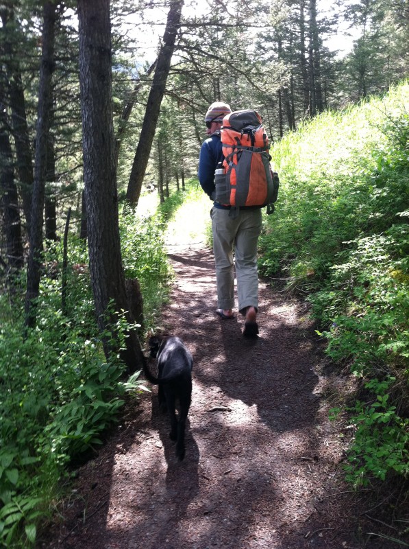
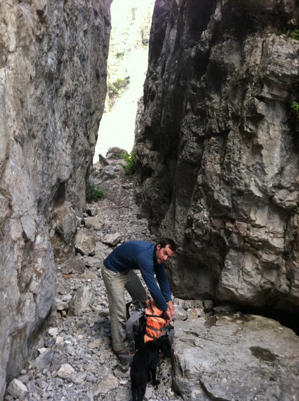
The easy hike into the climbing / viewing area.
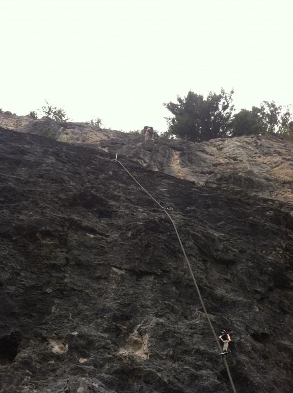
The Foyer, the entrance, a great place to warm up where several locals put up some new routes. Winds of Deception a 5.11d/12a is a classic route that must be climbed if it is within your grade, you can toprope and hang the route from the top if you just want to give it a try!
Ari Kaufman after a sweet run on Bio-Luminescence, a 70 foot route that you wished went on for atleast another 3,000 feet.

Ari Kaufman after a sweet run on Bio-Luminescence

Rocky Mountain Flowers – Mountain Blue Bell

Rocky Mountain Flowers – Arrow leaf

Natural Bridge Falls

Of course, the Dragon Slayer had to come with on this trip. The 2300 cubic inch pack is great for several different outings: BC skiing, hunting, and rock climbing. The bottle pockets can fit my 1.5 liter Kleen Kanteen! The main compartment gives you great organization with four internal pockets to keep everything from gathering at the bottom of bag. The Dragon will fit my Petzl harness and quickdraws, Five Ten shoes, RAB down jacket (in case the weather shifts, like it is known to in MT), a North Face rain jacket, a New England rope, and my lunch.